Hub-and Spoke Re-development Opportunity
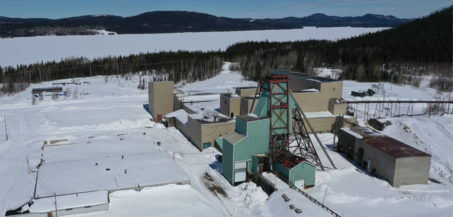
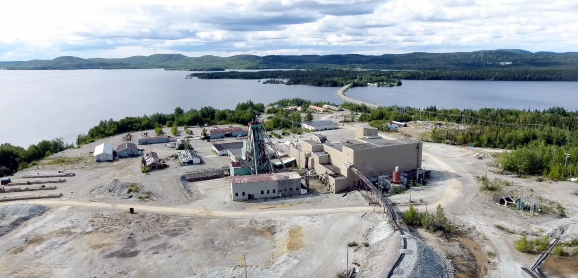
Doré Copper is focusing on a hub-and-spoke development strategy* with its Copper Rand mill serving as the ‘hub’ of the operation. The hub-and-spoke model with established infrastructure provides the following benefits:
*The technical feasibility and economic viability of the projects has not yet been established for the hub & spoke operation model.
Copper & Gold
Gold & Copper
Gold & Copper
Copper & Gold
PEA MAY 10, 2022
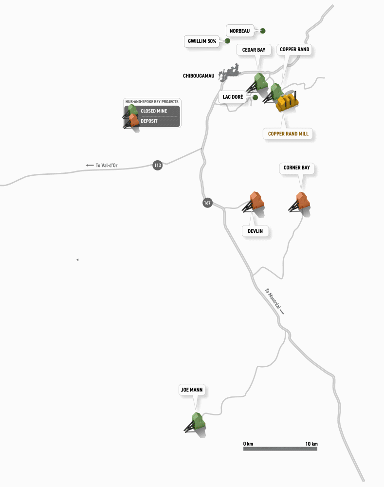
Doré Copper has consolidated a large land package of brownfield projects in and near Quebec’s Chibougamau prolific mining camp that has produced 1.6 B lbs of copper and 4.4 M oz of gold. The properties include 13 former mines, deposits and resource target areas, all within a 60 km radius of its Copper Rand mill.
On May 10, 2022, Doré Copper reported the results a Preliminary Economic Assessment (“PEA“) for a hub-and-spoke complex with the high-grade Corner Bay copper-gold deposit as its main underground mine along with the Devlin copper deposit and the former Joe Mann gold mine providing feed to its Copper Rand mill.
The PEA demonstrated attractive project economics with optionality for expansion into a significantly larger operation, re-establishing the Chibougamau mining camp as a long-life copper and gold producer.
The PEA envisions a hub-and-spoke model operation starting first with the underground development of the Devlin deposit via a ramp and secondly with the underground development of the Corner Bay deposit (main asset) via a ramp. Once the Devlin deposit is mined out (approximately 4 years), production at the Joe Mann mine would start and be funded out of cash flow from operations. Joe Mann benefits from an existing headframe and shaft, including all surface infrastructures.
A fixed crushing circuit and ore sorter plant (XRT) would be installed at Corner Bay and would reject the low-grade and dilution material from the Devlin and Corner Bay mines. The high-grade material would be transported by trucks to the refurbished and optimized Copper Rand mill. The filtered tailings would be transported to a dry stack tailings facility, which uses part of the footprint at the existing TMF.
The copper and gold concentrate produced would be transported to the port of Québec City for onward shipping to international smelters, or to a local smelter. Ocean Partners Ltd. has the off-take agreement (treatment and refining charges terms are within standard market rates).
The PEA was prepared by BBA Inc. with several consulting firms contributing to sections of the study, including SLR Consulting (Canada) Ltd., SRK Consulting (Canada) Inc., and WSP (Canada) Inc.
>> The technical report is available here.
The Company cautions that the results of the PEA are preliminary in nature and include inferred mineral resources that are considered too speculative geologically to have economic considerations applied to them to be classified as mineral reserves. There is no certainty that the results of the PEA will be realized.
| Description | Unit | Base Case1 24-month Trailing Avg |
|---|---|---|
| Metal Prices/FX | ||
| Copper (Cu) | US$/lb | 3.75 |
| Gold (Au) | US$/oz | 1,820 |
| Currency Exchange Rate | USD/CAD | 1.28 |
| Production Data | ||
| Resource Tonnes | T | 9,150,710 |
| Copper Equiv. Grade | % | 2.98 |
| Daily Mill Throughput | Tpd | 1,350 |
| Annual Processing Rate | Ktpa | 490 |
| Mine Life | Years | 10.5 |
| Avg Annual Production (in concentrate) | Mlbs CuEq | 53 |
| Operating Costs (LOM avg) | ||
| Total Operating Costs2 | C$/t mined | 106 |
| C$/t milled | 186 | |
| All-in Sustaining Costs3,4 | US$/lb CuEq | 2.24 |
| Capital Costs | ||
| Initial Capital | C$M | 180.6 |
| LOM Sustaining Capex | C$M | 402.4 |
| Financial Analysis (unlevered) | ||
| Pre-Tax NPV 8% | C$M | 367 |
| Pre-Tax IRR | % | 30.7 |
| After-Tax NPV 8% | C$M | 193 |
| After-Tax IRR | % | 22.1 |
| Payback Period (Production Start) | years | 5.5 |