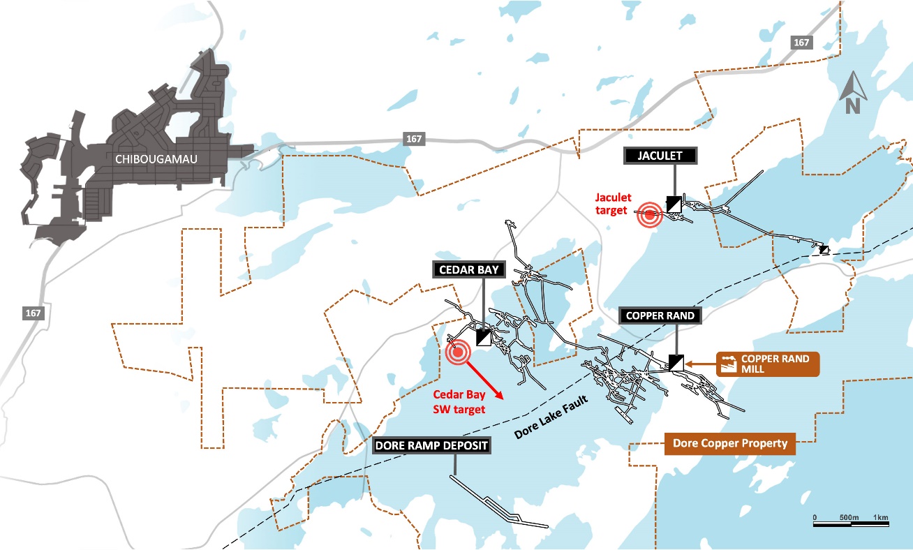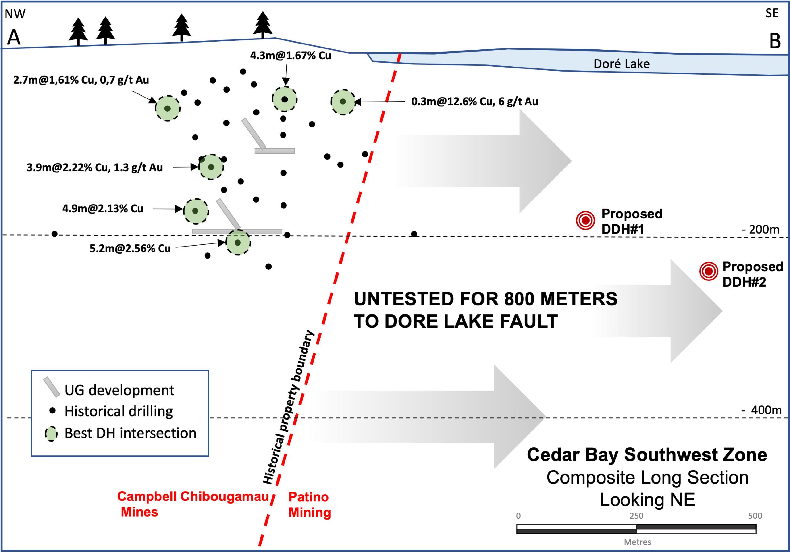
The Southwest Zone, located 300 meters southwest of the former Cedar Bay mine, was partially developed in the 1980’s by Campbell Chibougamau Mines Limited up to the 200-meter (650-feet) level, right at its property limit with Patino Mining at the time. The potential extension of the Cedar Bay Southwest Zone along strike to the southeast was very little tested by Patino Mining and subsequent companies that controlled that ground. In total, approximately 800 meters of strike length have not been tested up to the Lac Doré Fault.
Doré Copper plans to drill this target in 2024 to test the potential southeast extension of the Cedar Bay Southwest Zone.
The Cedar Bay mine operated from 1958 to 1990 and produced 3.9 million tonnes grading 1.56% Cu and 3.22 g/t Au1. The ore from the mine was processed at the Copper Rand mill located 5 kilometers by road. The deposit was mined to a depth of 670.5 meters and the existing shaft extends to a depth of 1,036 meters. Doré Copper, while private, completed four holes (including wedges) totaling 4,842 meters in 2018 and reported an Indicated resource of 130,000 tonnes at 9.44 g/t Au and 1.55% Cu, and an Inferred resource of 230,000 tonnes at 8.32 g/t Au and 2.13% Cu (effective date of December 31, 2018)2. During 2020, the Corporation completed 9,025 meters of drilling and successfully extended a number of mineralized lenses (the 10-20A and 10-20B).